Our arrival into Alaska via the Alaska Highway was a relief. We've never driven on a road worse than the 115 miles between Destruction Bay and Beaver Creek, Yukon Territory. Between Beaver Creek and the border, the road was a bit rough but there was a marked difference once we crossed into Alaska. The road became downright smooth!
We rolled into Tok (pronounced Toke), on June 3rd, and pulled into the Sourdough Campground. The owners are from Arizona and come up every summer, work their butts off and then head south again for the winters and some rest. We stayed only for one night but we took advantage of the breakfast offered to their campers each morning. Just as the name implies, their specialty is sourdough pancakes. They offered a choice of regular breakfast sausage or reindeer sausage. I was conservative in my choice and Rob ordered the reindeer sausage. I should have had the reindeer sausage because it was far superior in juiciness, texture and flavor. The sourdough pancakes were pretty good, but I still prefer buttermilk.
Did you know that sourdough pancakes was a diet staple during the Klondike Gold Rush? Miners used to carry their sourdough starters under their clothing and next to their bodies to keep the yeasty mix from dying in the bitter cold.
Our campsite at Sourdough Campground:

The following morning we took the Tok Cutoff Highway toward Palmer, Alaska. We had a spectacular view of the Wrangell Mountains from the highway and it was just a small taste of all the views yet to come.

The following photo is of Lion's Head Mountain found along the Glenn Highway. For me, the lion's head was recognizable only by driving east to west where the lion's snout was most visible.

We spent a month in Palmer, which is next door to Wasilla. Wasilla is a larger town than Palmer but both are typical American towns. They didn't feel any different than any other American town. There are certain preconceptions made by many who have lived nowhere but in the lower 48 that somehow Alaskans are backwards and uneducated. Not so. Those preconceptions are simply misconceptions. In fact, most Alaskans are far wiser because they'd be able to survive most any, shall we say, mishap that would test the wherewithal of the best educated New Yorker or San Franciscan or Chicagoan.
I arranged for us to spend such a lengthy time in Palmer in hopes that Rob would be able to do some paragliding. He never did fly. It turned out that all the launches in the Palmer/Wasilla area had to be hiked to and Rob can't do that anymore. We checked out the paragliding situation at Alyeska as well, which is a skiing resort with views of the Kenai Peninsula, but the paragliding club there required that he join their club and a year's membership be purchased. This kind of thing chaps Rob's hide. Why should a visiting paraglider have to pay a full year's dues? Just have a visiting pilot fee! And on top of that, to get to launch, one must pay for the tram ride up, which isn't cheap (although the view would be worth it). Besides, no one really showed any interest in neither welcoming a visiting pilot nor offering a site orientation.
Another factor that deterred flying was the rain. We had a lot of rain but it was similar to Hawaii. The forecast would call for 100% chance of rain, but that 100% chance of rain might have lasted all of 20 minutes at some point during the day. We learned not to make plans around weather forecasts. The forecasts changed hourly. Well, you'd have to wait at least until the morning of to know what to expect.
The weather in Alaska created some amazing clouds. On one particular day, sweeping wind lifted dirt and dust from the banks of the Matanuska River and created a spectral scene. By the time we fetched my camera and made our way to the riverbank, most of it was over but I did record a bit of it, and some of the clouds.


Something that was a surprise to us was how few wild animals we saw in Alaska. We saw more animals in Canada. Rob and I decided to take a day trip to the Alaska Wildlife Center where we were able to view some rescued critters.


This last photo is a wild eagle. Well, they're all wild but this one was not a member of those held in captivity. It was relentlessly harassed by a raven. And ravens were the one animal that were visibly abundant in Alaska.
Rob and I visited the Independence Mine State Historic Site located in the Talkeetna Mountains along Hatcher Pass from Palmer. Placer mining began in the area around 1897 and when veins of gold were discovered in the quartz, the mine was built in 1934. The mine was in operation, off and on, until 1950. They expected to open the mine again but never did. It was the largest hard-rock gold mining operation in the state second to Juneau. The weather took a toll on the buildings, machinery and other mining equipment left behind.

On our way to Independence Mine we stopped to look at the Little Susitna River and, of course, Rob makes friends wherever he goes.

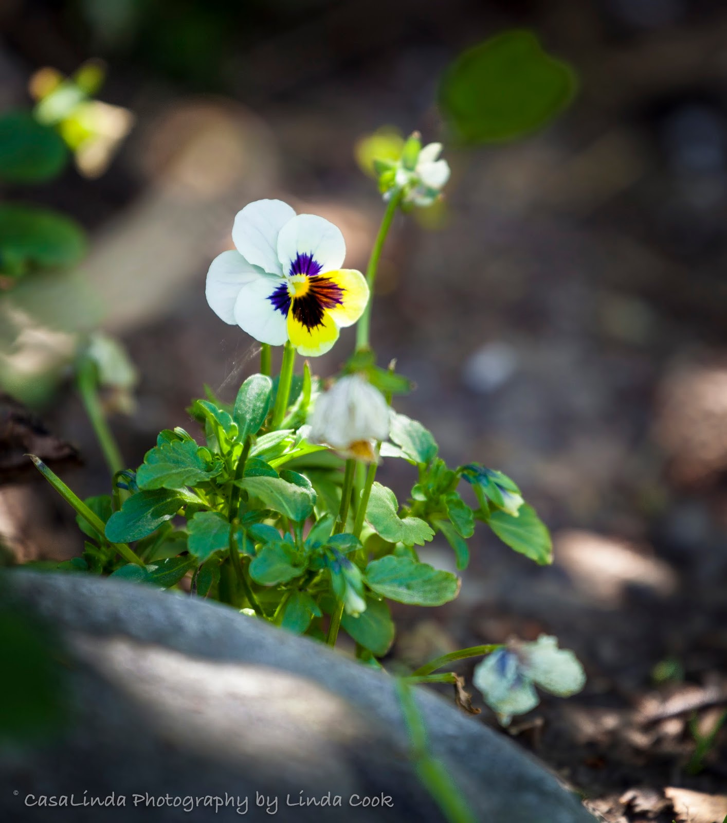
This little pansy was growing nearby:
A westward view from Hatcher Pass:

An eastward view from Hatcher Pass:

A cooking pot in the fireplace at the supervisor's house at the Independence Mine:

One of the slowly disintegrating buildings:

Stacks of burlap were left behind when the mine was closed in 1950:

This building was closer to the mine entrance. I'm not sure for what it was once used, but it hasn't withstood weather and time very well.

You can still find people gold panning in Fishhook Creek, which runs through Independence Mine property.

We spotted paragliders flying while heading down from the mine. When one of them landed in bushes, Rob helped the fellow get his lines untangled.

Remember when I mentioned people being invisible to the naked eye? Well, here's the photo that gave the impression that the subject, the glacier, was closer that it really was:
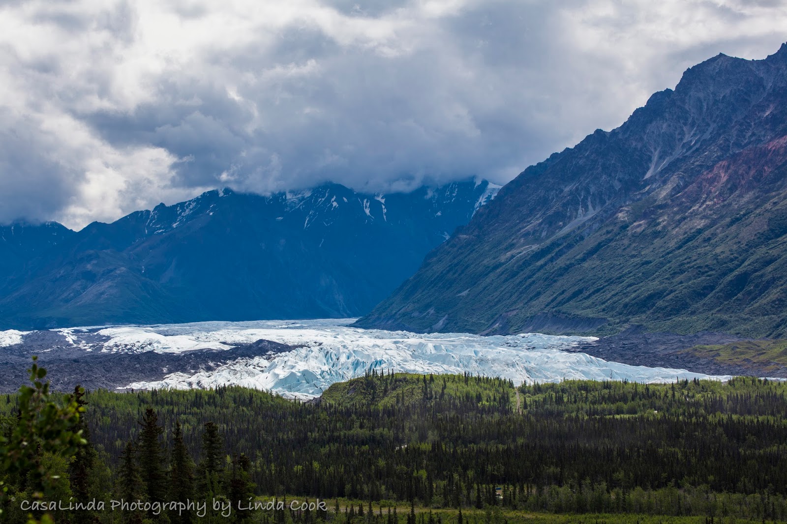
Now, look closely toward the left side of the glacier. See those vertical, dark marks? Those are people on a glacier tour. Hopefully you know that you can click on any one of these photos to see a larger version. Compare the landmarks in the two photos to see where these folks are walking in the zoomed-out version.

Yes, everything in Alaska is BIG. Big and beautiful. Stayed tuned for Alaska: The Last Frontier Part II.
No comments:
Post a Comment